

Cape Coral Drainage Planning Before New Home Construction
A beautiful house plan can become a costly problem if water movement gets treated as an afterthought. Cape Coral drainage planning belongs in the first site sketch because lot grading affects the home footprint, finished-floor elevation, driveway, pool, utilities, and permit documents.
Cape Coral lots often have little natural slope, and nearby swales, canals, easements, and neighboring properties can affect where stormwater goes. A drainage plan prepared after the house design may force changes to the slab, fill, access, or landscaping. Start with the site, then shape the home around what the property can support.
Why Cape Coral drainage planning starts before the house design
Drainage planning affects more than rainwater. It helps determine where the house can sit, how high the finished floor should be, how much fill the lot may need, and how water will reach an approved drainage conveyance.
The City of Cape Coral's residential plan review guidance calls for a site plan with drainage information. That plan should show existing conditions and proposed post-development conditions. In other words, reviewers need to understand what the lot does now and what your construction will change.
Begin with a current survey
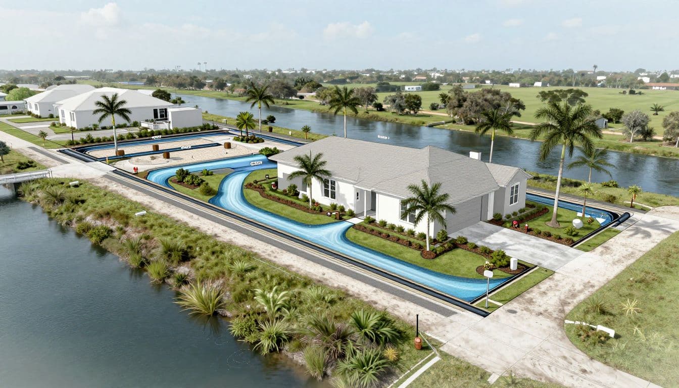
A boundary and topographic survey gives the design team reliable information about the property. It should identify property lines, spot elevations, the road crown, existing swales, drainage structures, easements, canals, and visible utility features.
The survey should also record relevant grades near adjoining developed lots. A neighboring driveway, retaining wall, or elevated yard can affect water movement along the property line. Guessing at these conditions can lead to a plan that looks reasonable on paper but sends runoff toward a low point or another home.
A civil engineer can use the survey to study existing drainage patterns and recommend a workable discharge path. That information should reach the architect or home designer before the floor plan is finalized.
Set the home footprint and elevations together
The house location, finished-floor elevation, surrounding grades, and drainage features need to work as one plan. Positive drainage should move surface water away from the structure without creating a new problem at the lot line.
Your site engineer may need to coordinate the slab elevation with fill, swales, driveway slopes, stormwater inlets, and any required retention or conveyance area. The correct solution depends on the parcel. A generic grading detail cannot replace site-specific engineering.
Small design changes matter. Moving the garage several feet, widening a lanai, or adding a side-entry driveway can change the available drainage path. Review those changes before construction documents are complete.
Review flood data and local jurisdiction first
Every Cape Coral lot deserves a parcel-level flood review. Use the City of Cape Coral's floodplain tools to check the flood zone, Base Flood Elevation (BFE), Design Flood Elevation (DFE), and available Elevation Certificates. The city identifies Forerunner as one of its online floodplain management tools.
Existing records can help, but they aren't always available or current. Cape Coral notes that buildings constructed before 1993 may not have an Elevation Certificate on file. A licensed surveyor may need to prepare a new certificate when the project or permit review requires one.
Flood zones can affect the plans and inspections
If the property sits in a flood hazard area, Cape Coral's floodplain rules may require review and approval from the Floodplain Administrator before development begins. The application may need a site plan or construction documents showing flood hazard areas, floodway boundaries, flood zones, BFE, and ground elevations.
The city also requires drainage paths that guide floodwater around and away from proposed structures. That requirement affects the relationship between the house, fill, open yard, pool area, and property boundaries.
Cape Coral's residential plan review guidance also states that an Under Construction Elevation Certificate is due after the floor slab inspection and before the tie beam inspection. Your project team should confirm the current documentation and inspection sequence for the specific permit.
City and county requirements aren't interchangeable
A property inside Cape Coral follows city procedures. A property in unincorporated Lee County follows county requirements, even when it is only a short distance outside the city boundary.
Lee County guidance says a Site Fill Grading Plan may be required with the building permit when the proposed final grade exceeds the crown of the road or an adjacent developed lot by more than 18 inches. The county's Residential Building Guide includes an exception for subdivisions with a current active Development Order, so the parcel's development status matters.
Lee County Land Development Code section 34-3104 also addresses runoff, erosion, and drainage conveyances. The site must be graded and maintained so construction doesn't send excess runoff onto adjacent developed properties. Runoff must reach an existing surface water management system or another approved offsite drainage conveyance.
If work occurs in a regulatory floodway, Lee County may require a No Rise Certificate. A Florida-licensed engineer must sign and seal the analysis showing that the work won't increase the base flood elevation.
A preconstruction Cape Coral drainage planning checklist
Use this Cape Coral drainage planning checklist before approving the final house and site plans.
- Confirm whether the parcel is inside Cape Coral or in unincorporated Lee County, then identify the responsible permitting authority.
- Order a current boundary and topographic survey that includes elevations, road conditions, swales, easements, canals, drainage structures, and nearby grades.
- Check the parcel's flood zone, BFE, DFE, floodway status, and available Elevation Certificates through the applicable city or county records.
- Ask a qualified civil engineer to document existing drainage and design the proposed grading, swales, pipes, inlets, retention, and discharge points.
- Place the house, garage, lanai, pool, driveway, and major outdoor areas on the grading plan before fixing the floor plan.
- Confirm how the design will maintain positive drainage away from the foundation and preserve drainage paths at the property edges.
- Coordinate utility trenches, septic features where applicable, irrigation, landscaping, fences, and hardscape so they don't block the planned flow path.
- List every permit document and inspection requirement, including floodplain approvals, grading information, Elevation Certificates, and any floodway analysis.
- Establish who will update the drainage documents if the architect, owner, or builder changes the house footprint or finished elevations.
- Review the final grading plan against the construction schedule so the site remains stable and drains correctly during building.
A checklist is useful only when the design team treats it as a sequence. Flood data and surveys should come before final elevations. Feature coordination should come before concrete, fill, and utility installation.
Coordinate drainage with every exterior feature
A drainage plan can work perfectly around the house and fail after the driveway, pool, or landscaping is installed. Each exterior feature changes the ground surface and can block, collect, or redirect water.
Driveways and swales need a shared design
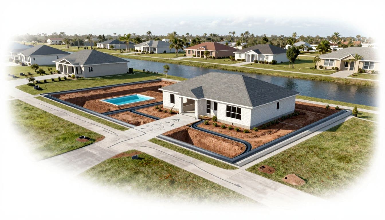
Driveways often cross the same side-yard swales that carry water toward a street system or other approved conveyance. A raised driveway, solid curb, or misplaced culvert can interrupt that path.
The site plan should show driveway elevations, swale cross-sections, culverts or crossings where needed, and how water moves during heavy rain. Don't assume the paving contractor can solve this in the field. A change in slope may direct runoff toward the garage, sidewalk, or neighboring property.
Cape Coral advises property owners to maintain swales and drainage pathways. New construction should preserve their function unless an approved design provides another drainage solution.
Pools, landscaping, and utilities change the grade
Pool excavation removes soil, while the pool deck, screen enclosure, retaining features, and equipment pad add hard surfaces or elevation changes. The pool plan must match the house grading plan, including deck drainage and overflow routing.
Landscaping can also affect water. Dense soil, raised planting beds, decorative borders, and new walls may stop water from reaching a swale or inlet. Irrigation should not discharge against the foundation or saturate a low area.
Utility trenches need attention as well. Poorly compacted backfill can settle and create a channel toward the house. The builder and civil engineer should identify utility corridors without cutting across a swale or blocking an existing drainage conveyance.
Protect neighboring properties
Your plan should show what happens at every property line. Water shouldn't leave the site in excess of preconstruction discharge toward an adjacent developed lot.
That concern applies during construction and after completion. Clearing, fill placement, stockpiled soil, temporary access, and construction debris can block a swale or send sediment into a drainage system. The site team needs temporary controls and a final grading plan that protects the existing drainage pattern.
Review the drainage plan before signing off
A plan can contain the right terms and still be difficult to understand. Ask the design team to trace the water path across the lot in plain language.
You should be able to identify the high points, low points, finished-floor elevation, driveway crossing, swales, inlets, pipes, retention areas, and final discharge point. Ask what happens during a major rain event and where water goes if one feature becomes temporarily blocked.
The plan should also show how the final grades meet the house, garage, patios, pool deck, sidewalks, and property lines. Check whether landscape beds, fences, walls, or future additions could interfere with those grades.
Confirm documents, responsibilities, and revisions
Before construction starts, confirm which professional prepares each document. A surveyor handles surveyed elevations and certificates. A civil engineer develops site drainage and grading details. The architect or designer coordinates the house layout. The builder uses the approved documents to sequence earthwork, utilities, slab work, and exterior improvements.
When the house moves, the drainage plan may need to change too. Keep one current set of coordinated drawings rather than allowing the floor plan, pool plan, and grading plan to drift apart.
A builder experienced with custom home building services in Cape Coral can help keep design decisions connected to the construction sequence. Cape Coral's permitting guidance says the city moved to an online-first process for new permit applications and related activities through EnerGov beginning July 1, 2026. Confirm the current submission process and document requirements before filing.
Conclusion
A new Cape Coral home should be designed around a documented drainage solution, not placed on the lot first and adjusted later. Start with the survey, flood data, jurisdiction review, and site-specific engineering. Then coordinate the home elevation with swales, driveways, pools, utilities, landscaping, and neighboring grades.
The strongest plan gives water a clear path away from the structure while preserving the drainage system around the property. Good Cape Coral drainage planning happens before the final floor plan, before the permit package, and before heavy equipment reaches the lot.